Queen Elizabeth national park is located in western Uganda on the drier leeward side of Rwenzori Mountain Ranges. The protected area covers 1,978 sq.km which is includes Kyambura and Kigezi wildlife reserves in the western arm of the Great East African rift valley.
Within its borders, there are diverse geographic landforms including volcanic fields with both freshwater and alkali crater-filled lakes. There are also escarpments, open savanna plains, tropical forests, papyrus wetlands, and the 45 sq.km Kazinga channel which connects Lake George and lake Edward. The waterway is located within the park connecting two rift valley lakes, George and Edward.
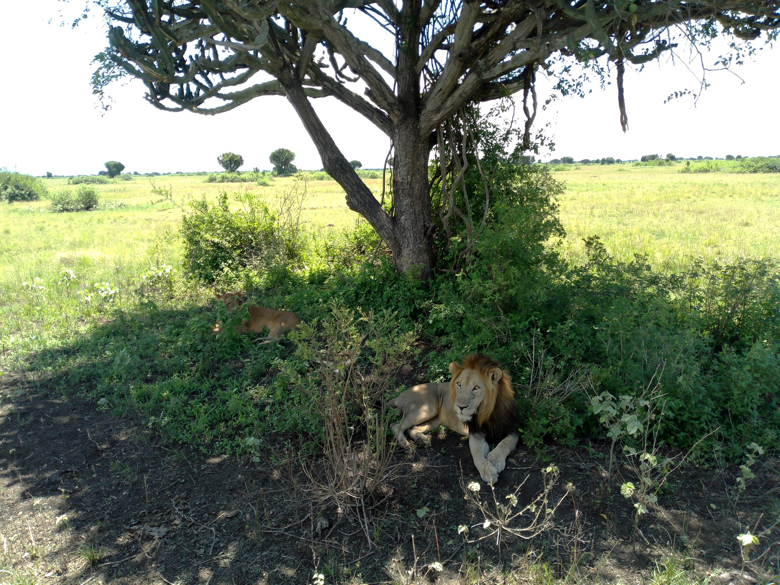
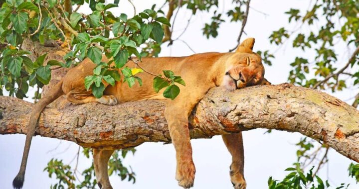
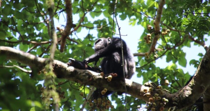
The diverse habitat supports rich biodiversity which include 98 mammal species, 8 primate species including chimpanzees, and 612 species of birds. Queen Elizabeth National Park receives the most visitors of all the 10 national parks in Uganda. Wild animals you expect to see include the amazing tree-climbing lions, leopards, spotted hyenas, buffaloes, elephants, hippos, Nile crocodiles, white-tailed mongoose, and a variety of antelopes such as topi, waterbucks, Uganda kobs, and bushbucks. There are no giraffes, zebras and impalas. Primates species include chimpanzees, red tailed monkeys, blue monkeys, and black and white colobus monkeys.
Places to visit
Those intending to visit the park, there are 2 sectors which include Kasenyi plains in the north and Ishasha wilderness in the south. The Uganda Wildlife Authority main visitor center at Mweya peninsula is in Kasenyi accessible via the main Katunguru gate if coming from Kasese. Other entry gates include Kabatoro for those coming from Fort Portal and Kibale forest and Ishasha for those coming from Bwindi south west Uganda.
Kasenyi has the widest range of lodges and is the most visited park in Uganda. Some of the highlights of Kasenyi area include Kyambura gorge and Kalinzu forest reserve for chimp tracking, Maramagambo forest for nature walks to the bat caves, lake Katwe salt mines, Mweya peninsula, and the Kazinga channel for boat cruises. Ishasha area has fewer lodgings and is primarily used by travelers hoping to see tree climbing lions. For those traveling to or from Bwindi and Mgahinga on a gorilla safari, it makes a fantastic stopover.
Climate around Queen Elizabeth national park
The highest elevation is 1,390m and the lowest is 910 m, making it the 3rd lowest point in Africa. Altitude and location in the shadow of Mount Rwenzori are the reasons why Kasese and Queen Elizabeth national park have sparse annual rainfall. Given that the rain falls directly on the slopes of Rwenzori and the windward side of DR Congo.
The dry season from July to September on average receives 112mm (4.4 inches) per annum, making Kasese a tropical dryland. April to May and October to November are the wettest months, having 606 mm (23.9 inches). The northern Kasenyi area is much drier with short grass savanna, thorny acacia thickets and African milk trees (euphorbia trigona). The factor may be that herbivores including elephants, hippos, buffaloes, waterbucks, and Uganda kobs overgraze their range. Bush burning is used to improve forage along tracks, which attracts wild animals closer for viewing during game drives.
Ishasha wilderness
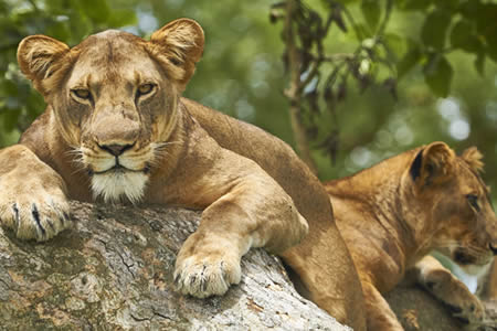
The southern Ishasha wilderness area interconnects to the south with Rwindi plains of Virunga national park (DR Congo). It is the flattest point with an altitude of 910 meters above sea level. As such, the vegetation in Ishasha is mainly dense savanna woodland with river flat-topped acacia and African fig trees (Ficus cyathistipula), which lions prefer to climb. Riverine acacia trees occur along the Ishasha and Ntungwe rivers.
Elephants use Ishasha as a route during their annual migration across the greater Virunga landscape. Some central African mammals are also often spotted in Ishasha including the Congo buffalo and forest elephants. In general, Ishasha is wetter than the Kasenyi plains. Queen Elizabeth national park’s average daytime temperature in the rainy season is between 17°C (63°F) – 29°C (84°F) and 16°C (64°F) – 31°C (87°F) in the dry season.
Major landforms in the Kasenyi area
The topography of Queen Elizabeth national park was shaped by tectonic and volcanic events during the formation of the rift valley. Some of the most spectacular features to visit include the Katwe – Kikorongo crater lake field, Kyambura gorge, and Kazinga channel.
The Kazinga channel
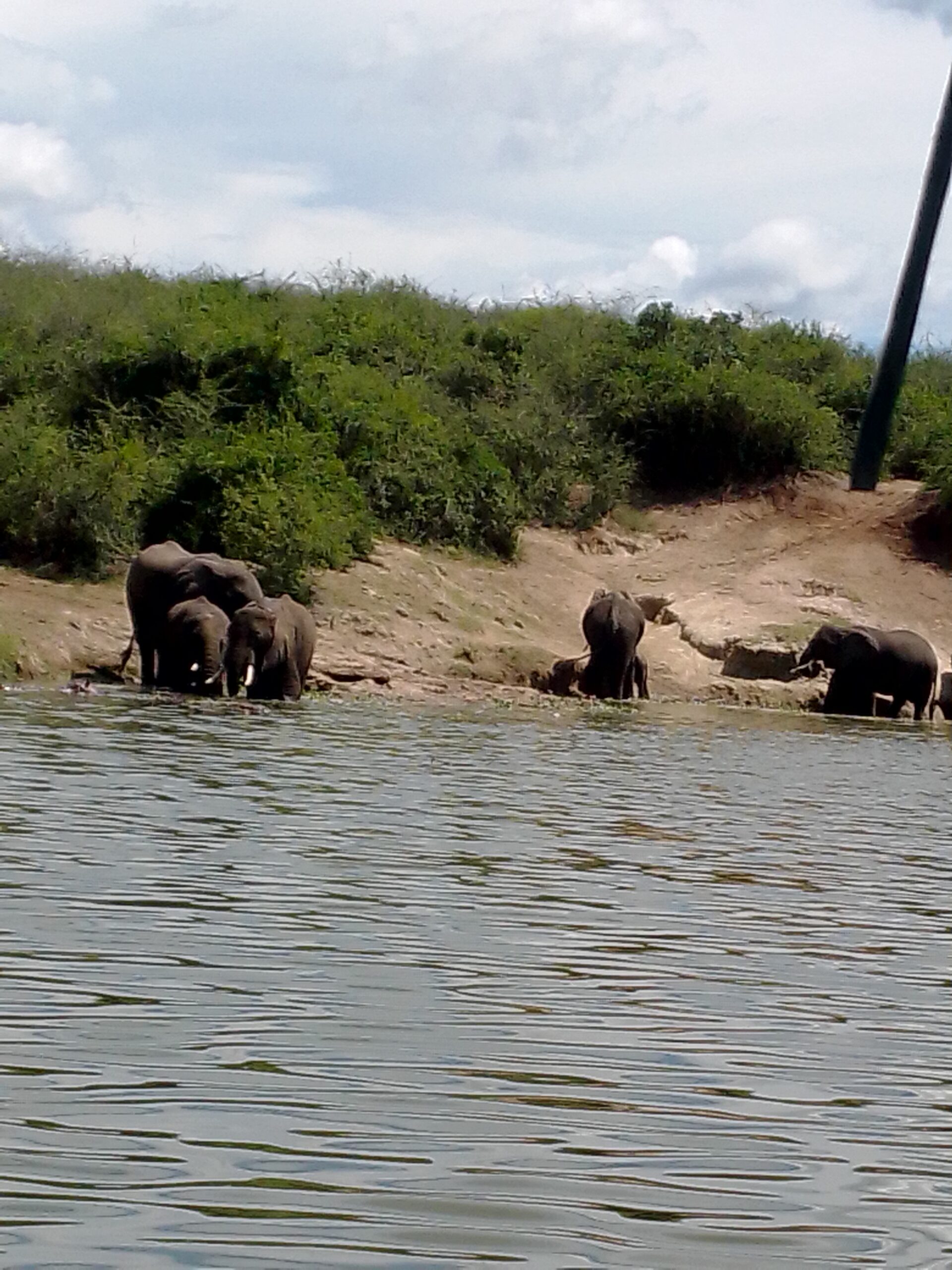
Lake Edward and Lake George are connected by the Kazinga channel, which is 45 km long. Water flows from the former to latter and forms the Lake George wetland, a Ramsar site for endangered water bird species such as the shoebill stork. The local tour guides have also come up with the Big 5 of Kazinga channel which include elephant, buffalo, Nile crocodile, African fish eagle, and hippo. Chances are high to see all of them during the boat cruise available for booking at Katunguru or Mweya peninsula through a tour operator or local guide.
Mweya peninsula
From this vantage point, you can see much of the Kazinga channel, lakes and the distant Rwenzori mountain range. Mweya has the Uganda Wildlife visitor information center, the park headquarters. Given that the place is surrounded by water, wild animals often graze around including elephants, warthogs, and hippos.
The northern explosion crater lakes
This volcanic field known as the Katwe – Kikorongo covers an area of 180 sq.km and contains over 8 both alkali and fresh water filled crater lakes of which Katwe and Kitagata hot springs are the most spectacular. Other lakes in the area include Nyamunuka, Kyemengo, Mahenga, Murumuri, and Maseekye.
With an altitude of 1,067 m (3,501 feet), the elevated area at Katwe Tourism Information Center offers scenic views of the lakes. The formation of these lakes was a result of explosive eruptions that occur when water comes into contact with hot magma. The volcanic soils in the field contain a variety of rocks such as melilite basalts, nepheline foidite and maars which are relatively less fertile in the rift valley area north of Lake Edward.
Lake Katwe
The biggest of all, Katwe is a shallow salt water lake with a maximum depth of 1.6m. The depression is 9 km long and 2.5 km in diameter. The waters have high alkali content above 30 mgl, making it the biggest salt mine in East Africa. According to the Katwe Tourism Information Center, the lake contains over 12 million tons of salt. Salt mining has been taking place since the 14th century with no successful industrial extraction. Men do the extraction mainly by hand and tools like wood and hoes. People own salt pans privately and the lake is partitioned into over 1,000 pans accordingly. Visiting Lake Katwe offers a chance to witness the process of salt mining.
Lake Munyanyange
Next to lake Katwe is lake Munyanyange, which attracts lesser flamingos that are known to migrate from the salt lakes of Natron (Tanzania) and Naivasha (Kenya). The best time to see flamingos there is during the rainy season in April to May or October to November. Given that water levels are high, there’s a lot of green algae for the birds to mate and then return back to Kenya and Tanzania for breeding. In other words, lake Munyanyange is the mating ground for pink flamingos.
Kitagata crater lake and hotsprings
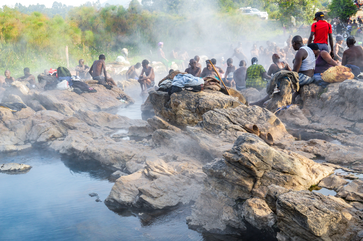
Lake Kitagata and hot springs are located in Sheema district about 95 km (2-hour drive) south of Lake Katwe. You can visit the place whilst traveling along the Kasese- Ishaka-Ntungamo-Katunguru road. The lake is 2.4 km long and a maximum depth of 9 meters. The lake is heated by geothermal steam to produce hot springs, which indicates the underlying active volcanic zone.
There are 2 hot springs locally called Mulago and Mugabe with water of up to 80 °C (176 °F). Kitagata is a Runyankole Rukiga dialect which means warm water in English. Local people believe that the spring water contains healing waters due to the high content of mineral salts including calcium sulfate.
Similar hot springs are found in Semliki national park, the Sempeya male and female hot springs. However, the Kitagata ones are a cultural site left behind by the Bachwezi demigods. The folklore about them is that Kalisa, who was a prime minister, had a human body in a symmetrical shape. One side of his body could be touched and the other couldn’t be seen. This is indicated by the presence of one footprint on the rocks.
Kyambura gorge
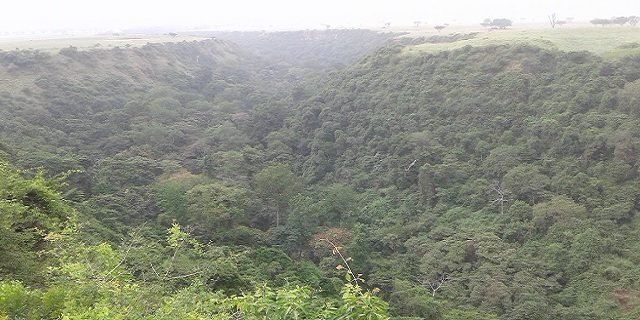
The Kyambura gorge is an 11-km-long, 100-meter-deep underground passageway that connects Kazinga channel from the Kichwamba escarpment at the northern end of the Kasenyi plains. The gorge contains tropical forests which are home for several primate species including chimpanzees, red tailed monkeys, and blue monkeys.
Savanna elephants also visit the gorge and can be seen during nature walks. Chimpanzee tracking is the main activity in Kyambura gorge with high chances to see them. Kyambura wildlife reserve is a buffer zone within the Queen Elizabeth protected area. There’s a raised platform to look down below into the gorge. The Kyambura area also hosts a wide range of accommodations available for booking through a tour operator.

